
Sub-Saharan Africa Map Quiz
How the Scales are Structured
Who Usually Takes This Test?
See How You Compare
Below is a preview of how scores are typically distributed across each scale.
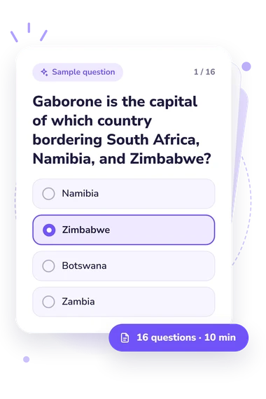
Example Questions From the Test
- Namibia
- Zimbabwe
- Botswana
- Zambia
- Burundi
- Rwanda
- Uganda
- Malawi
- Zambia
- Malawi
- Zimbabwe
- Eswatini
Sub-Saharan Africa Map Quiz - Description and methodology of the test
Designed for learners, travelers, teachers, and anyone refreshing regional geography, the Sub Saharan Africa Map Quiz offers a concise way to check regional map knowledge. This sub-Saharan Africa quiz gives a focused snapshot of your current level and points toward useful topics for further study. The result is a practical geography check, not a measure of general intelligence.
What This Assessment Measures
Questions in this Subsaharan Africa Map Quiz combine geographic fact recognition with knowledge of relative location, borders, and physical features. Items ask you to connect capitals with countries, use neighboring states as border clues, recognize coastlines and islands, and identify rivers, lakes, mountains, and deserts.
The intended result is a single regional knowledge profile. The Sub-Saharan Africa Knowledge scale spans 0-16, with three descriptive bands:
- Foundations to build (0-6) indicates that country and border recognition needs more practice.
- Developing map knowledge (7-12) shows that many locations are familiar, with gaps in relative position.
- Strong map knowledge (13-16) reflects consistently accurate knowledge of regional countries, borders, and major physical features.
Together, the bands indicate the level of your regional knowledge and can suggest areas for review.
Methodology and Evidence Base
Each item presents a geographic prompt and four answer choices. You select the country, capital, boundary, water feature, or landform that fits the clue; no map drawing or route explanation is required. That structure suits a map quiz about Africa south of the Sahara, where you identify the option that best fits the geographic clue.
Hagge's study offers the closest methodological comparison, treating country-location identification as a learnable form of geographic knowledge. The questionnaire's country-location items are conceptually consistent with that study, but this questionnaire is not an adaptation, validation, or standardized version of it. White and O'Sullivan provide broader context for assessing place knowledge and spatial relationships. Finlayson and the Central Intelligence Agency provide regional reference points.
Scoring for this sub-Saharan map quiz is reported as one performance result with descriptive bands, not a multi-trait profile. The score reflects selected facts and clues. The result uses the displayed descriptive categories. Classroom exposure, travel, media, or naming familiarity can affect performance, and the short format cannot represent every aspect of geographic understanding.
- Hagge, Patrick D. (2023). Find It on a Map: Country Location Identification in a University Geography Classroom, 2016-2022. Journal of Geography, 122(5), 105-114. 10.1080/00221341.2023.2224374
- White, Sheida, and Christine Y. O'Sullivan. (1995). 1994 NAEP Assessment in Geography. NCES 96-810. Washington, DC: National Center for Education Statistics.
- Finlayson, Caitlin. (2019). Sub-Saharan Africa. In World Regional Geography. Pressbooks.
- Central Intelligence Agency. (2024). The World Factbook: Africa. Washington, DC: Central Intelligence Agency.
Updated: