
State Abbreviations Quiz
How the Scales are Structured
Who Usually Takes This Test?
See How You Compare
Below is a preview of how scores are typically distributed across each scale.
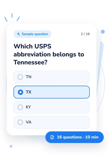
Example Questions From the Test
- Kansas
- Tennessee
- Kentucky
- Louisiana
- TN
- TX
- KY
- VA
- DL
- DC
- MD
- DE
State Abbreviations Quiz - Description and methodology of the test
People who work with addresses, forms, travel records, or basic U.S. geography can use this state abbreviations quiz to check whether familiar two-letter codes are matched to the right state. For learners who want a Southern postal code quiz, the result shows how consistently they recognize and apply the codes in everyday address-style situations.
What the Questionnaire Measures
This assessment covers USPS two-letter codes for the 16 states in the U.S. Census Bureau’s South region. It suits people checking knowledge, studying geography, or handling forms where errors can change destinations. The result describes performance on this Southern set, not complete knowledge of every state.
As a states and abbreviations quiz, it tests several practical abilities by asking respondents to match codes with states:
- Recognizing a state from its code shows whether you can decode it;
- Choosing a Southern state’s code shows whether you can recall it;
- Correcting an invalid entry shows whether you can apply the code; and
- Distinguishing Virginia codes shows whether you can separate similar abbreviations.
The result uses one scale, Southern State Abbreviations Knowledge (0-16). Foundation to build covers 0-6, Developing knowledge covers 7-12, and Strong knowledge covers 13-16. These bands show the respondent’s performance on the tested codes.
Methodology and Evidence Base
The response format is direct, making this a practical US abbreviations quiz: each item presents an address, form, or identification scenario with four answer choices. Some ask for a state from a code; others reverse the task or require a correction. The format tests recognition and application rather than open-ended spelling or map recall.
USPS Publication 28 supplies the postal-code reference for the answer key, while the U.S. Census Bureau’s regional classification defines the Southern set. The questionnaire is conceptually consistent with these references. Its displayed bands are descriptive; no norm-referenced interpretation or validation study has been established for this online questionnaire. The result is interpreted through its total and named bands; no separate weighting rule is stated.
The study by Nichols, Olmsted-Hawala, Feuer, and Wang examines how state displays function in surveys and forms. It offers context for the address-style scenarios, not evidence that this questionnaire measures presentation or has established validity. The score represents performance on these questions. As a short online knowledge check, guessing, prior exposure to mailing forms, and momentary attention can affect the result; it does not establish broad postal proficiency.
- United States Postal Service. Publication 28 - Postal Addressing Standards. October 2024.
- U.S. Census Bureau, Geography Division. 2010 Census Regions and Divisions of the United States. 2010.
- Nichols, Elizabeth, Erica Olmsted-Hawala, Shelley Feuer, and Lin Wang. “Don’t Abbreviate: An Experimental Comparison of the U.S. State Display Designs Commonly Used in Surveys and Forms.” Journal of Technical Writing and Communication, 54(1), 2024, 3-23. 10.1177/00472816221118246