
Guess the Asian Quiz
How the Scales are Structured
Who Usually Takes This Test?
See How You Compare
Below is a preview of how scores are typically distributed across each scale.
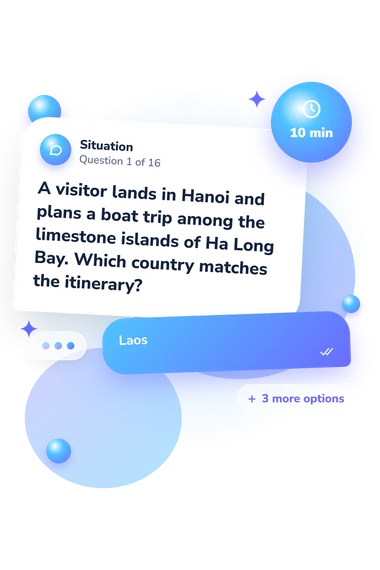
Example Questions From the Test
- Laos
- China
- Vietnam
- Thailand
- Mongolia
- Turkmenistan
- Azerbaijan
- Kazakhstan
- Indonesia
- The Philippines
- Malaysia
- Sri Lanka
Guess the Asian Quiz - Description and methodology of the test
Designed for readers who want to strengthen their geographic awareness, the Guess the Asian Quiz turns country recognition into a practical self-check. It suits travelers, students, and curious learners who enjoy an Asian geography quiz built around map-based questions. The result summarizes overall performance on the country-identification questions and places it in the displayed band.
What This Assessment Explores
The questionnaire tests recognition of Asian countries through travel-style clues. Items connect destinations with capitals, cities, landmarks, languages, currencies, islands, borders, and regional geography. The test is an Asian country quiz that measures factual country knowledge and clue integration, not ethnicity, ancestry, or personal identity.
The result uses one displayed scale:
- Asian Countries Knowledge measures country identification from geographic, cultural, and landmark clues, with a score range of 0-16. Emerging Explorer (0-6) signals some recognized clues with room to review; Developing Navigator (7-12) signals a solid regional foundation; Accomplished Navigator (13-16) signals accurate identification across a broad range of clues.
These bands describe performance on this question set. They can guide review of country locations, capitals, and landmarks, but do not establish language fluency, cultural expertise, or personal familiarity with Asian communities.
Methodology and Evidence Base
Each prompt gives a short travel or map-style scenario with four answer choices. You select one country; one point is awarded for each correct answer, and the total reflects successful identifications. This format tests recall and clue integration rather than personality traits.
This country identification test uses geographic, cultural, language, currency, and landmark clues. Recognition depends on the scenario and its factual details, not on faces or appearance.
Its approach is conceptually consistent with Friedman and deWinstanley (2006), who studied mental representations of countries, and Hagge (2023), whose classroom work used country-location identification. These sources support the focus on country knowledge and location recall; this questionnaire is not presented as either published instrument.
The total-score rule is transparent, but the bands are catalogue interpretations rather than population norms or clinical cutoffs. Results can vary with travel, school exposure, language familiarity, attention, and lucky guesses, so they describe performance in this moment rather than complete geographic or cultural understanding.
- Friedman, William J., and Patricia A. deWinstanley. "The mental representation of countries." Memory, vol. 14, no. 7, 2006, pp. 853-871. 10.1080/09658210600782925
- Hagge, Patrick D. "Find It on a Map: Country Location Identification in a University Geography Classroom, 2016-2022." Journal of Geography, vol. 122, no. 5, 2023, pp. 105-114. 10.1080/00221341.2023.2224374
Updated: