
Map Quiz
How the Scales are Structured
Who Usually Takes This Test?
See How You Compare
Below is a preview of how scores are typically distributed across each scale.
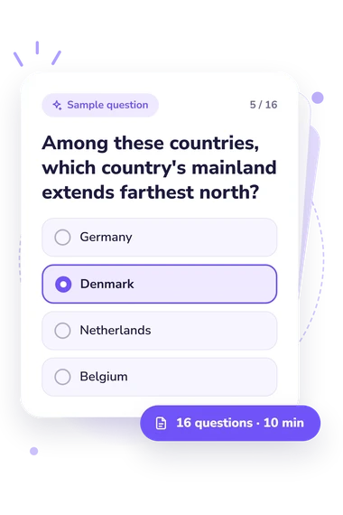
Example Questions From the Test
- Ecuador
- Colombia
- Peru
- Venezuela
- Mauritius
- Sri Lanka
- Comoros
- Madagascar
- Germany
- Denmark
- Netherlands
- Belgium
Map Quiz - Description and methodology of the test
People who want to check how confidently they reason from location clues can use this game of map-based questions to examine practical world-geography knowledge. The map quiz is intended for learners and curious adults who want a focused way to test relationships among countries, borders, waterways, islands, and landforms. An online geography quiz with maps can reveal which kinds of spatial connections feel secure and which deserve review.
What This Assessment Measures
The result shows how accurately you use geographic relationships to identify places from clues. Items connect countries with borders, coastlines, seas, straits, islands, rivers, latitude, and peninsulas, so a geography quiz built around maps tests location knowledge in context rather than isolated memorization.
The score uses one scale, World Geography Knowledge (0-16), with three bands: Foundations to build (0-6) means locations are partly familiar and borders need review; Developing map knowledge (7-12) means many placements are correct but regional gaps remain; Strong world geography knowledge (13-16) means clues are interpreted accurately.
Four dimensions shape the result:
- Country placement and borders show how you recognize neighboring states and enclaves.
- Coasts, seas, and straits show how you connect places with surrounding waters.
- Islands and landforms show how you interpret channels and peninsulas.
- Rivers, latitude, and physical features show how environmental clues guide identification.
Methodology and Evidence Base
Each question gives a geographic description or spatial relationship with four answer choices. You select the country, water body, island, river, or feature that best fits the clue. Scoring counts correct answers across the questionnaire; the result does not assign separate scores to the thematic groups.
This format is conceptually consistent with Dunn (2011), who treats location knowledge as part of spatial thinking and geography learning. Saarinen and MacCabe (1995) add context through research on mental-map quality and geographic literacy, while Watrin, Schroeders, and Wilhelm (2023) examine declarative knowledge in a broader cognitive framework. The questionnaire is not an adaptation of these studies or a standardized, norm-referenced test.
For practice with map-based questions, the result provides descriptive feedback about performance on this item set. Scores can vary with schooling, travel, language, familiarity with place names, and attention while answering. Uncertainty about a clue may reflect a memory gap rather than a stable ability. Reviewing missed relationships and revisiting regions or physical features can make the exercise more useful for study planning.
- Dunn, James M. (2011). Location Knowledge: Assessment, Spatial Thinking, and New National Geography Standards. Journal of Geography, 110(2), 81-89. 10.1080/00221341.2010.511243
- Saarinen, Thomas F., and Charles L. MacCabe. (1995). World Patterns of Geographic Literacy Based on Sketch Map Quality. The Professional Geographer, 47(2), 196-204. 10.1111/j.0033-0124.1995.00196.x
- Watrin, Luc, Ulrich Schroeders, and Oliver Wilhelm. (2023). Gc at its boundaries: A cross-national investigation of declarative knowledge. Learning and Individual Differences, 102, 102267. 10.1016/j.lindif.2023.102267
Updated: