
West States and Capitals Quiz
How the Scales are Structured
Who Usually Takes This Test?
See How You Compare
Below is a preview of how scores are typically distributed across each scale.
Example Questions From the Test
- Henderson
- Elko
- Carson City
- Sparks
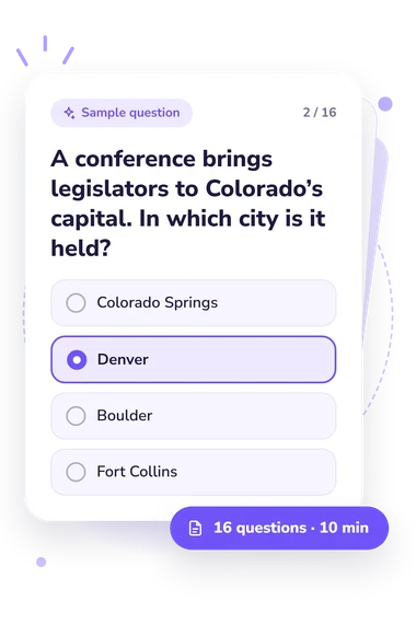
- Colorado Springs
- Denver
- Boulder
- Fort Collins
- Anchorage
- Fairbanks
- Sitka
- Juneau
West States and Capitals Quiz - Description and methodology of the test
Students, travellers, teachers, and curious adults can use the West States and Capitals Quiz to check whether familiar city names are correctly linked to the states they represent. It suits anyone practising U.S. geography or preparing for classroom and civic-learning activities. The result shows how accurately you answer capital-city questions across the region, while its format as a western states and capitals quiz keeps practice focused on recognition and application.
What This Assessment Explores
Rather than testing general knowledge about every major city, the questionnaire focuses on the official seats of government in the 13 states assigned to the U.S. Census Bureau’s West region. Items ask respondents to recall a capital directly, distinguish it from a larger or better-known city, or select a correct state-capital pairing. As a quiz about West-region states and capitals, it helps readers practise distinguishing capitals from prominent cities and verifying state-capital pairings.
The result is organized around one knowledge dimension:
- West States and Capitals Knowledge, 0-16, indicates how accurately you identify the region’s capital cities; Starting Point covers 0-6, Developing Knowledge covers 7-12, and Strong Knowledge covers 13-16.
A lower band suggests pairings need review, whereas a higher band indicates reliable performance across direct and applied questions. The score describes performance on capital-city tasks, not broader geographic ability.
Methodology and Evidence Base
Each item uses four-option multiple choice. The 16 questions mix direct recall with scenarios involving government visits, map labels, study-card corrections, and contrasts between a capital and a larger city. This tests retrieval and discrimination rather than explanation. The west capitals quiz asks respondents to apply a capital-state pair rather than merely recognize it in a repeated format.
Scoring is based on answer correctness, and the bands describe performance on these questions. The U.S. Census capital-city table (1985) supplies the reference pairings, and the U.S. Census Bureau’s 2022 Geographic Levels supports the West-region definition. Engstrom, Hammond, and Scott’s 2013 study offers historical context about capital locations and relocations; the quiz is conceptually consistent with that discussion, not an adaptation of the study or validated by it.
Performance can vary with schooling, travel, recent study, guessing, and attention. This quiz about West-region capitals is therefore a snapshot of current knowledge of the state-capital pairs, and its bands are descriptive rather than norm-referenced.
- U.S. Census Bureau. Consolidated Federal Funds Report: Fiscal Year 1984, Volume I: County Areas. U.S. Department of Commerce, Bureau of the Census, 1985, Appendix C, “County Locations of State Capital Cities.”
- U.S. Census Bureau. “2022 Geographic Levels.” U.S. Department of Commerce, 2025.
- Engstrom, Erik J., Jesse R. Hammond, and John T. Scott. “Capitol Mobility: Madisonian Representation and the Location and Relocation of Capitals in the United States.” American Political Science Review 107, no. 2 (2013): 225-240. 10.1017/S000305541300004X